
license: unknown
Description
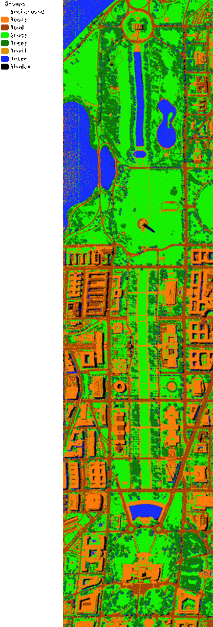
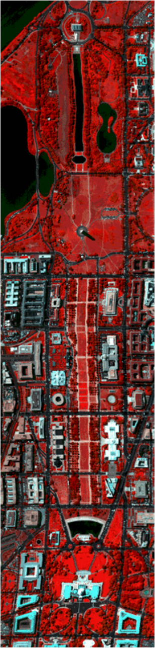
This dataset contains airborne hyperspectral data flightline over the Washington DC Mall provided with the permission of Spectral Information Technology Application Center of Virginia who was responsible for its collection. The sensor system HYDICE used in this case measured pixel response in 210 bands in the 0.4 to 2.4 μm region of the visible and infrared spectrum. Bands in the 0.9 and 1.4 μm region where the atmosphere is opaque have been omitted from the data set, leaving 191 bands. The data set contains 1208 scan lines with 307 pixels in each scan line. It totals approximately 150 Megabytes.
Characteristics
Washington DC Mall data set classes, labels and the number of samples.
| # | Class | Samples |
|---|---|---|
| 1 | Roofs | 21419 |
| 2 | Street | 9834 |
| 3 | Grass | 22873 |
| 4 | Trees | 6882 |
| 5 | Path | 1105 |
| 6 | Water | 11063 |
| 7 | Shadow | 3061 |
Quick look
Credits
Dataset originally available as part of the Multispec project at: https://engineering.purdue.edu/~biehl/MultiSpec/hyperspectral.html
Copyright (C) 1994-2020 Purdue Research Foundation. Work leading to MultiSpec was funded in part by NASA Grants NAGW-925, NAGW-3924 and NAGW5-3975. Supported by AmericaView (www.americaview.org)
The hyperspectral data set (dc.tif) of the Washington, DC mall area is provided with the permission of Spectral Information Technology Application Center of Virginia who was responsible for its collection.